DRAFT
Northern Kansas to Southern Kansas
Snapshot: Length: 1,888 miles | Length in MAFC: 240 miles | Intersecting Interstates: I-10, I-20, I-35, I-40, I-70, I-80, I-90, I-94
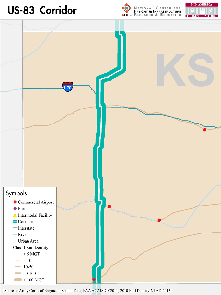
US-83 is an important north-south route through Kansas within the MAFC. Nationally, it travels through six states, running from the Mexican border at Brownsville, TX a total of 1,885 miles to the Canadian border just north of Westhope, ND. Since 1931, US-83 has served as an international link across the United States. Along its route from north to south, US-83 intersects with every major east-to-west railroad and Interstate highway, including I-94, I-90, and I-80 north of Kansas. In Oakley, Kansas, it crosses I-70, connecting this important north-south route to an east-west interstate that is essential to the state.
South of Kansas, US-83 additionally crosses I-40, I-20 and I-10 in Texas as well as I-35.
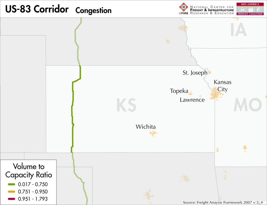
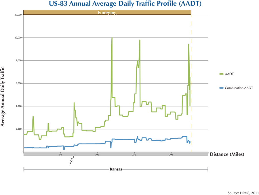
For most of its duration US-83 is still a two lane highway, but continues to be an essential transportation route for the communities of western Kansas. Due to its importance to this region, the MAFC Regional Freight Study categorizes US-83 as an emerging freight corridor. Freight traffic can be expected to be maintained or grow further along this corridor as trucks continue to provide a cost-effective and reliable transportation mode for the industries of western Kansas to reach their final markets. These highway links will be essential for future economic vitality in the region.
US-83 is not tolled at any point of its route. There is no north-south rail service or water freight service in this area of Kansas. In Kansas, the MAFC designated portion of US-83 passes through Liberal and Garden City.
National Connectors
There are no national connectors on the US-83 corridor in the MAFC region.
Freight Projects Impacting Truck Traffic
US-83 is being maintained by Kansas DOT and does not appear to have any major projects being undertaken within the study region.
Truck Traffic
US-83 is a 240-mile corridor within one state in the MAFC: Kansas.
- VMT 2007: 657,121
- Truck VMT 2007: 194,809
- Percent Truck VMT: 29.65 percent
Operational Efficiency (ITS)
There are no message signs or cameras along the US-83 corridor.
Kansas collaborates with Iowa, Missouri, Nebraska, and Oklahoma through ITS Heartland.
Greenhouse Gas Emissions
- Yearly tons of CO2 assuming 4 mpg: 180,000
- Yearly tons of CO2 assuming 7.5 mpg: 97,000
Methodology
- Data: Truck Counts (HPMS 2011)
- Assume 4 and 7.5 miles per gallon
- No control for level of service or elevation changes
- 22.3 lbs. of CO2 per gallon of diesel
Fuel and Truck Parking
| The data set used to determine truck parking along interstates did not include US highways. Therefore, there are no data on truck parking for US-83. Compressed Natural Gas (CNG) and Liquified Natural Gas (LNG) stations are listed to the right. | US-83 | CNG | LNG |
| Public | 0 | 0 | |
| Private | 0 | 0 | |
| Planned | 0 | 0 | |
| Total | 0 | 0 |
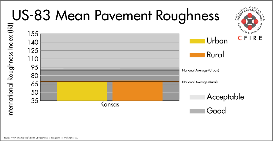
Infrastructure Condition
The International Roughness Index (IRI) measures the cumulative amount of vertical deviation (the bumpiness or roughness) for each segment of road, and is reported as a ratio in inches per mile. IRI values less than 95 are generally considered good, while values between 95 and 170 are generally considered acceptable. Since only corridor segments with reported IRI values from the 2011 HPMS dataset were considered in this analysis, some states may be missing from certain corridors.
The IRI is used as a measurement to determine infrastructure conditions within the Highway Performance Monitoring System (HPMS) such as pavement deterioration, pavement condition trends, cost allocation studies, and other analytical purposes. It is reported, at a minimum, for all road segments that fall under the Full Extent classification which includes the National Highway System (NHS), all principal arterials (interstates, freeways, and expressways), and rural minor arterials within the Sample Panel dataset. The data is collected by the states and submitted to the FHWA. The FHWA verifies the data and houses it within the HPMS. For more historical information, see MnDOT’s Introduction to the International Roughness Index.
Freight Facilities
There are no freight facilities on the US-83 corridor in the MAFC region.
Freight Rail
There is no parallel freight rail service in this corridor. A number of freight railroads intersect this north/south corridor. The Union Pacific’s Pratt Subdivision crosses the corridor at Liberal, KS with rail density between 10-50 million gross tons (MGT) according to the 2010 rail density data available from the 2013 National Transportation Atlas Database. The BNSF La Junta Subdivision crosses at Garden City (5-10 MGT). The Union Pacific Sharon Springs Subdivision crosses at the intersection with I-70 (10-50 million MGT).
Passenger Rail
The Southwest Chief service (Chicago-Los Angeles) intersects the U-83 corridor at Garden City where there is a station. BNSF owns the line.
Airports
There are no air cargo airports that service the US-83 corridor in the MAFC region.
Ports
There are no Marine Highways intersecting or running parallel to the US-83 corridor. Shippers wishing to ship via the inland waterways must first transport their goods to either the Port of Kansas City in order to access the M-70 Marine Highway or to the Port of Catoosa near Tulsa, OK in order to access the M-40 Marine Highway Connector.

Freight Generators, Warehouses, and Distribution Centers
There are a total of 1,310 freight generators employing 13,706 people within three miles of the US-83 corridor, and a total of 1,522 freight generators employing 18,649 people within 10 miles of the corridor. The US-83 corridor does not intersect any metropolitan statistical areas in the MAFC region. Freight generators were determined by using the NAICS codes prescribed for freight-related sectors in NCFRP Report 19, and include agriculture, mining, manufacturing, wholesale trade, retail trade, transportation and warehousing, and eating and drinking places.
References
- FHWA Interstate Brief (2011). US Department of Transportation.